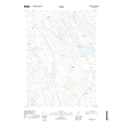
2018 Map of Schoodic Lake
USGS Topo · Published 2018About this map
The Narraguagus River and its numerous tributaries dominate this drainage landscape in Washington County, where the sprawling Great Heath and Corliss Swamp define the low-lying terrain. This 2018 survey captures a region managed for both aviation and industry, featuring the Deblois Flight Strip in the northwest and extensive access roads like Schoodic Rd and Baseline Rd serving the surrounding timber and blueberry lands.
Find a feature on this map
60 named features on this map. Tap any name to fly to it.
Don’t see what you’re looking for? This feature index may not catch every label — zoom into the map to look around manually.
Map Details
Editions of this 2018 Schoodic Lake Map
This is the sole edition of this map. No revisions or reprints were ever made.
Other maps of this area

1902 · Cherryfield
USGS Topo · 1:62,500

1904 · Cherryfield
USGS Topo · 1:62,500

1929 · Lead Mountain
USGS Topo · 1:48,000

1930 · Tunk Lake
USGS Topo · 1:48,000

1932 · Tunk Lake
USGS Topo · 1:62,500

1932 · Lead Mountain
USGS Topo · 1:62,500

1941 · Tug Mountain
USGS Topo · 1:62,500

1942 · Cherryfield
USGS Topo · 1:62,500

1942 · Tunk Lake
USGS Topo · 1:62,500

1943 · Tug Mountain
USGS Topo · 1:62,500