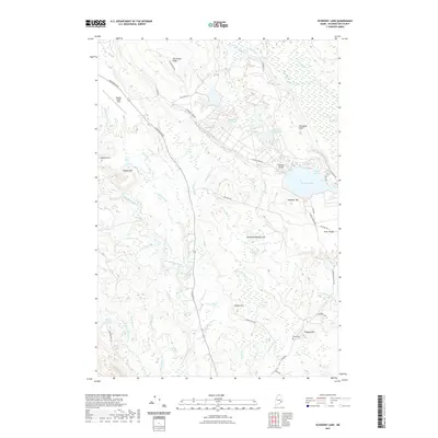
2021 Map of Schoodic Lake
USGS Topo · Published 2021About this map
Schoodic Lake and its surrounding wetlands define this portion of Washington County, where the Narraguagus River and its various branches create a complex hydrographic network. The landscape is a mosaic of low-lying bogs like the Great Heath and Corliss Swamp punctuated by isolated rises such as Schoodic Hill and Peaked Hill. The presence of the Deblois Flight Strip near the western edge and several blueberry-related road names like Blueberry Land Rd hint at the area's specialized land use and aviation history.
Find a feature on this map
65 named features on this map. Tap any name to fly to it.
Don’t see what you’re looking for? This feature index may not catch every label — zoom into the map to look around manually.
Map Details
Editions of this 2021 Schoodic Lake Map
This is the sole edition of this map. No revisions or reprints were ever made.
Other maps of this area

1902 · Cherryfield
USGS Topo · 1:62,500

1904 · Cherryfield
USGS Topo · 1:62,500

1929 · Lead Mountain
USGS Topo · 1:48,000

1930 · Tunk Lake
USGS Topo · 1:48,000

1932 · Tunk Lake
USGS Topo · 1:62,500

1932 · Lead Mountain
USGS Topo · 1:62,500

1941 · Tug Mountain
USGS Topo · 1:62,500

1942 · Cherryfield
USGS Topo · 1:62,500

1942 · Tunk Lake
USGS Topo · 1:62,500

1943 · Tug Mountain
USGS Topo · 1:62,500