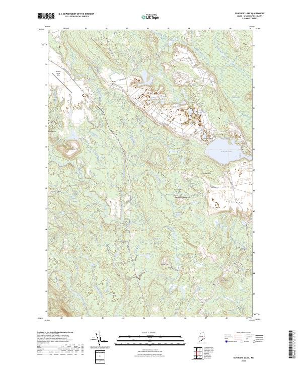
2024 Map of Schoodic Lake
USGS Topo · Published 2024About this map
Schoodic Lake and its surrounding wetlands form the heart of this landscape in Washington County. The terrain is defined by a dense network of drainage, where the Narraguagus River and its West Branch receive flow from numerous tributaries like Salmon Brook and Lawrence Brook. The presence of the Deblois Flight Strip in the northwest corner near Beddington Rd highlights the area's strategic utility, while the remote Morse Cem on the southeastern slopes of Peaked Hill provides a point of interest for local genealogy. To the east, the sprawling Great Heath and Thousand Hills create a distinct topographical pattern, contrasting with the prominent elevations of Schoodic Hill and Hardwood Ridge. This map captures a mosaic of glacial landforms and water bodies, from Trout Cove to the numerous small ponds such as East Pike Brook Pond and the Spectacle Ponds.
Find a feature on this map
62 named features on this map. Tap any name to fly to it.
Don’t see what you’re looking for? This feature index may not catch every label — zoom into the map to look around manually.
Map Details
Editions of this 2024 Schoodic Lake Map
This is the sole edition of this map. No revisions or reprints were ever made.
Other maps of this area

1902 · Cherryfield
USGS Topo · 1:62,500

1904 · Cherryfield
USGS Topo · 1:62,500

1929 · Lead Mountain
USGS Topo · 1:48,000

1930 · Tunk Lake
USGS Topo · 1:48,000

1932 · Tunk Lake
USGS Topo · 1:62,500

1932 · Lead Mountain
USGS Topo · 1:62,500

1941 · Tug Mountain
USGS Topo · 1:62,500

1942 · Cherryfield
USGS Topo · 1:62,500

1942 · Tunk Lake
USGS Topo · 1:62,500

1943 · Tug Mountain
USGS Topo · 1:62,500