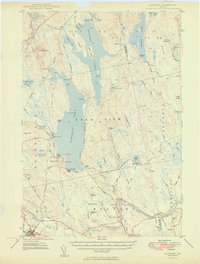
1949 Map of Schoodic
USGS Topo · Published 1949About this map
The Piscataquis and Penobscot county line cuts through a landscape defined by expansive water bodies and the heavy infrastructure of the north woods in the late 1940s. The industrial character of the region is evident in the convergence of two major rail lines: the Canadian Pacific and the Bangor and Aroostook, which serviced timber interests and local hubs like Milo and Medford. Large lakes, including Schoodic Lake and Seboeis Lake, are dotted with remote camps and landings such as Packards and Knights Landing, indicating a dual identity of commercial logging and seasonal recreation.
Find a feature on this map
110 named features on this map. Tap any name to fly to it.
Don’t see what you’re looking for? This feature index may not catch every label — zoom into the map to look around manually.
Map Details
Editions of this 1949 Schoodic Map
2 editions found
Other maps of this area

1917 · Passadumkeag
USGS Topo · 1:62,500

1932 · Dover-Foxcroft
USGS Topo · 1:48,000

1933 · Boyd Lake
USGS Topo · 1:62,500

1935 · Dover-Foxcroft
USGS Topo · 1:62,500

1940 · Sebec
USGS Topo · 1:48,000

1942 · Lincoln
USGS Topo · 1:62,500

1943 · Sebec
USGS Topo · 1:62,500

1947 · Schoodic
USGS Topo · 1:62,500

1949 · Schoodic
USGS Topo · 1:62,500

1951 · Boyd Lake
USGS Topo · 1:50,000