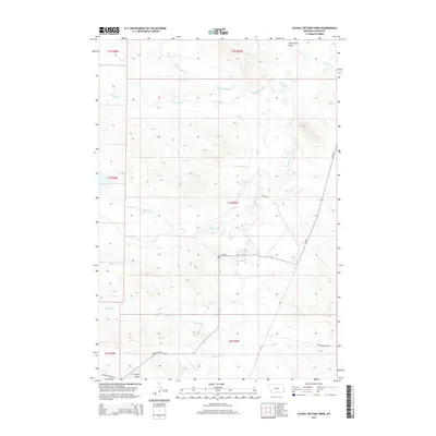
2014 Map of School Section Creek
USGS Topo · Published 2014About this map
Boxelder Cr and its many tributaries carve through this high-plains landscape in Montana's eastern corner, where the drainage patterns of School Section Cr and Skull Cr define the local topography. This 2014 survey captures a sparsely populated region of Carter County, characterized by a network of seasonal watercourses and remote rangeland. The presence of features like Horsetrack Draw and Ewalt Draw suggests a landscape shaped by intermittent runoff, typical of the Missouri River Basin’s edge. Modern road networks, including MT-323 and Larson Loop Rd, provide the primary access to these large parcels of land. The map also records locally significant terrain markers such as Sheep Mountain Rd and Ridgeway Ridge Rd, which follow the higher elevations between creek valleys like Cabin Creek and McCarty Cr.
Find a feature on this map
25 named features on this map. Tap any name to fly to it.
Don’t see what you’re looking for? This feature index may not catch every label — zoom into the map to look around manually.
Map Details
Editions of this 2014 School Section Creek Map
This is the sole edition of this map. No revisions or reprints were ever made.
Other maps of this area

1954 · Ekalaka
USGS Topo · 1:250,000

1956 · Ekalaka
USGS Topo · 1:250,000

1958 · Ekalaka
USGS Topo · 1:250,000

1965 · Ekalaka
USGS Topo · 1:250,000

1979 · Dead Boy Divide
USGS Topo · 1:24,000

1979 · Ikey Creek
USGS Topo · 1:24,000

1980 · Taylor Hills
USGS Topo · 1:24,000

1980 · Belltower
USGS Topo · 1:24,000

1980 · Prairie Dog Creek
USGS Topo · 1:24,000

1980 · Belltower Butte
USGS Topo · 1:24,000