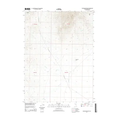
2015 Map of Schoolhouse Butte
USGS Topo · Published 2015About this map
Jackson Mountains dominate the western edge of this landscape, descending into a series of drainage systems that define the high desert terrain of Humboldt County. The land is organized around the seasonal and perennial flows of Trout Cr, Big Cedar Cr, and Little Cedar Cr, which move eastward from the higher elevations. Human impact on the hydrology is evident at the Bull Cr Ditch, a managed water feature reflecting the region's reliance on water control for ranching and survival in an arid environment.
Find a feature on this map
20 named features on this map. Tap any name to fly to it.
Don’t see what you’re looking for? This feature index may not catch every label — zoom into the map to look around manually.
Map Details
Editions of this 2015 Schoolhouse Butte Map
This is the sole edition of this map. No revisions or reprints were ever made.
Other maps of this area

1886 · Disaster
USGS Topo · 1:250,000

1893 · Disaster
USGS Topo · 1:250,000

1954 · Vya
USGS Topo · 1:250,000

1958 · Vya
USGS Topo · 1:250,000

1961 · Bottle Creek
USGS Topo · 1:62,500

1962 · Vya
USGS Topo · 1:250,000

1966 · Donna Schee Peak
USGS Topo · 1:62,500

1966 · King Lear Peak
USGS Topo · 1:62,500

1972 · Hobo Canyon
USGS Topo · 1:24,000
1985 · Jackson Mts
USGS Topo · 1:100,000