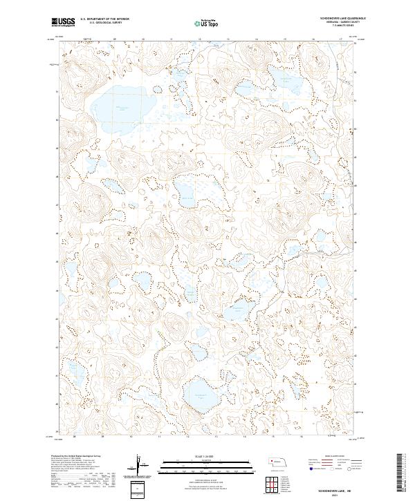
2021 Map of Schoonover Lake
USGS Topo · Published 2021About this map
Schoonover Lake and a dense network of high-plains water bodies define this pocket of Garden County. The landscape is characterized by a high concentration of named lakes, including Sandbeach Lake, Stockholm Lake, and Bluebaker Lake, which appear as shallow basins across the terrain. These water features suggest the unique hydrology of the Nebraska Sandhills, where the water table often intersects with the surface to form perennial lakes and wetlands.
Find a feature on this map
19 named features on this map. Tap any name to fly to it.
Don’t see what you’re looking for? This feature index may not catch every label — zoom into the map to look around manually.
Map Details
Editions of this 2021 Schoonover Lake Map
This is the sole edition of this map. No revisions or reprints were ever made.
Other maps of this area

1896 · Browns Creek
USGS Topo · 1:125,000

1899 · Browns Creek
USGS Topo · 1:125,000

1948 · Antioch
USGS Topo · 1:62,500

1948 · Lakeside
USGS Topo · 1:62,500

1949 · Mumper
USGS Topo · 1:62,500

1949 · Antioch
USGS Topo · 1:62,500

1950 · Storm Lake
USGS Topo · 1:62,500

1950 · Lakeside
USGS Topo · 1:62,500

1954 · Scottsbluff
USGS Topo · 1:250,000

1955 · Alliance
USGS Topo · 1:250,000