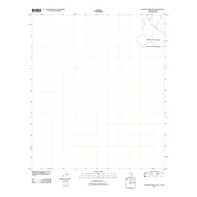
2010 Map of Schroder Arroyo OE S
USGS Topo · Published 2010About this map
The Rio Grande snakes through the northeastern corner of this remote borderland, defining the international boundary between the United States of America and Estados Unidos Mexicanos. This 2010 survey illustrates a sparsely developed desert landscape where water remains the primary geographical marker, notably featuring an Oxbow Lake formed by the shifting river channel. Accessibility in this arid terrain is limited to the Indian Hot Springs Rd, which winds through the river valley. The map provides a precise record of the river's path and the administrative border during a period of modern boundary management, showing the intersection of natural hydrology and national jurisdiction in a quiet stretch of the West Texas and Chihuahua borderlands.
Find a feature on this map
5 named features on this map. Tap any name to fly to it.
Don’t see what you’re looking for? This feature index may not catch every label — zoom into the map to look around manually.
Map Details
Editions of this 2010 Schroder Arroyo OE S Map
This is the sole edition of this map. No revisions or reprints were ever made.
Other maps of this area

1897 · Eagle Mountain
USGS Topo · 1:125,000

1916 · Eagle Mountain
USGS Topo · 1:125,000

1959 · Marfa
USGS Topo · 1:250,000

1965 · Marfa
USGS Topo · 1:250,000
1972 · Indian Hot Springs
USGS Topo · 1:24,000
1972 · Cedar Arroyo
USGS Topo · 1:24,000
1984 · Indian Hot Springs
USGS Topo · 1:100,000
1993 · Indian Hot Springs
USGS Topo · 1:100,000
2010 · Neely Canyon OE S
USGS Topo · 1:24,000
2010 · Schroder Arroyo
USGS Topo · 1:24,000