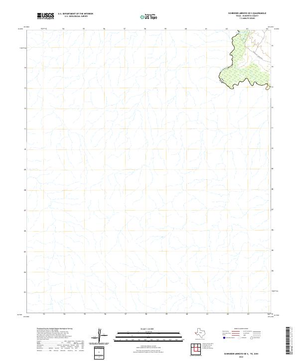
2022 Map of Schroder Arroyo OE S
USGS Topo · Published 2022About this map
Rio Grande waters define the international boundary in this arid stretch of Hudspeth County, where the river's shifting path is evidenced by features like Oxbow Lake. The landscape is dominated by the intricate drainage patterns of the desert floor, with the winding Indian Hot Spring Rd providing the primary corridor through the northeastern corner of the map. This area represents a quiet segment of the borderlands near the Usa Eum boundary, where the river's hydrology is the primary architect of the terrain. The presence of the lake and the historical road trace a long history of seasonal water and movement through this remote Texas landscape.
Find a feature on this map
4 named features on this map. Tap any name to fly to it.
Don’t see what you’re looking for? This feature index may not catch every label — zoom into the map to look around manually.
Map Details
Editions of this 2022 Schroder Arroyo OE S Map
This is the sole edition of this map. No revisions or reprints were ever made.
Other maps of this area

1897 · Eagle Mountain
USGS Topo · 1:125,000

1916 · Eagle Mountain
USGS Topo · 1:125,000

1959 · Marfa
USGS Topo · 1:250,000

1965 · Marfa
USGS Topo · 1:250,000
1972 · Indian Hot Springs
USGS Topo · 1:24,000
1972 · Cedar Arroyo
USGS Topo · 1:24,000
1984 · Indian Hot Springs
USGS Topo · 1:100,000
1993 · Indian Hot Springs
USGS Topo · 1:100,000
2010 · Neely Canyon OE S
USGS Topo · 1:24,000
2010 · Schroder Arroyo
USGS Topo · 1:24,000