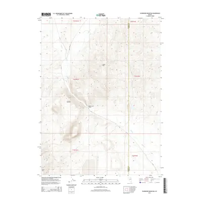
2014 Map of Schroeder Mountain
USGS Topo · Published 2014About this map
Maggie Cr carves a significant path through this section of the Independence Mountains, defining the drainage patterns that have shaped the land between Elko and Eureka counties. Rising above the valley, Schroeder Mountain and Maggie Peak serve as prominent landmarks in a terrain dominated by high-elevation ridges and deep creek beds. The map shows the convergence of several waterways, including James Cr and Lynn Cr, which feed into the main canyon.
Find a feature on this map
18 named features on this map. Tap any name to fly to it.
Don’t see what you’re looking for? This feature index may not catch every label — zoom into the map to look around manually.
Map Details
Editions of this 2014 Schroeder Mountain Map
This is the sole edition of this map. No revisions or reprints were ever made.
Other maps of this area

1952 · Carlin
USGS Topo · 1:62,500

1955 · Winnemucca
USGS Topo · 1:250,000

1957 · Beowawe
USGS Topo · 1:62,500

1958 · Winnemucca
USGS Topo · 1:250,000

1958 · Huntsman Ranch
USGS Topo · 1:24,000
1958 · Swales Mountain
USGS Topo · 1:24,000

1962 · Winnemucca
USGS Topo · 1:250,000

1968 · Rodeo Creek NE
USGS Topo · 1:24,000

1968 · Welches Canyon
USGS Topo · 1:24,000

1968 · Swales Mountain NW
USGS Topo · 1:24,000