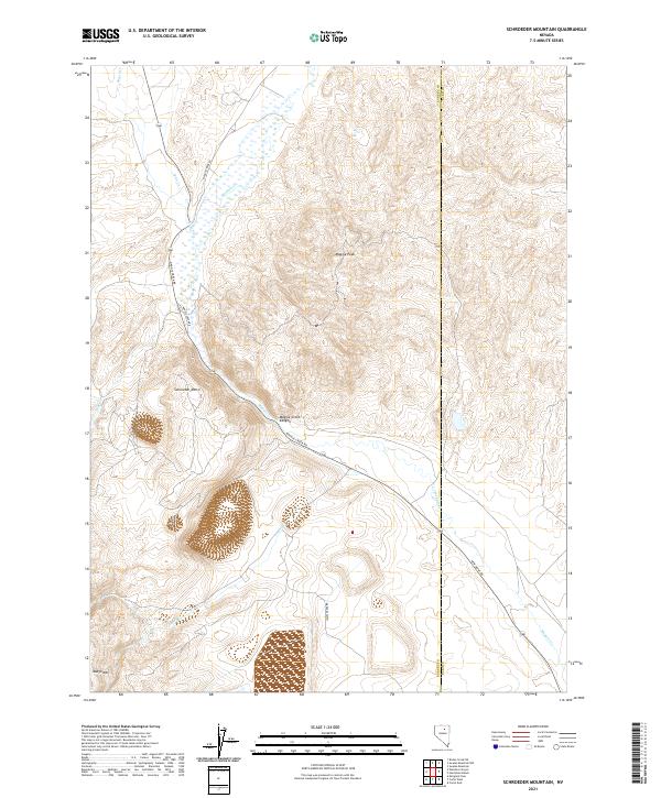
2021 Map of Schroeder Mountain
USGS Topo · Published 2021About this map
Maggie Cr defines the drainage of this high-desert landscape in central Nevada, carving a path through the distinct terrain of Maggie Creek Canyon. The map area is dominated by significant elevations including Schroeder Mtn and Maggie Peak, which overlook a network of seasonal watercourses like James Cr and Lynn Cr. This region, straddling the border of Eureka and Elko Counties, shows a landscape largely shaped by its topography and the transport routes that follow the natural contours of the land. The presence of New Mont Rd and Maggie Creek Rd indicates the vital modern infrastructure required to navigate this portion of the Great Basin. To the southwest, Marys Mtn rises above the surrounding flats, anchoring the southwestern corner of this survey.
Find a feature on this map
19 named features on this map. Tap any name to fly to it.
Don’t see what you’re looking for? This feature index may not catch every label — zoom into the map to look around manually.
Map Details
Editions of this 2021 Schroeder Mountain Map
This is the sole edition of this map. No revisions or reprints were ever made.
Other maps of this area

1952 · Carlin
USGS Topo · 1:62,500

1955 · Winnemucca
USGS Topo · 1:250,000

1957 · Beowawe
USGS Topo · 1:62,500

1958 · Winnemucca
USGS Topo · 1:250,000

1958 · Huntsman Ranch
USGS Topo · 1:24,000
1958 · Swales Mountain
USGS Topo · 1:24,000

1962 · Winnemucca
USGS Topo · 1:250,000

1968 · Rodeo Creek NE
USGS Topo · 1:24,000

1968 · Welches Canyon
USGS Topo · 1:24,000

1968 · Swales Mountain NW
USGS Topo · 1:24,000