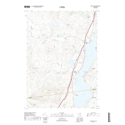
2019 Map of Schroon Lake
USGS Topo · Published 2019About this map
Schroon Lake dominates this landscape within the southeastern reaches of the Adirondack Park, where the water transitions through The Narrows toward the southern hamlet of Adirondack. The terrain is defined by a series of significant elevations including Beech Hill, Ledge Hill, and Severance Hill, which overlook the winding course of the Schroon River and its various tributaries like Rogers Brook and Platt Brook.
Find a feature on this map
78 named features on this map. Tap any name to fly to it.
Don’t see what you’re looking for? This feature index may not catch every label — zoom into the map to look around manually.
Map Details
Editions of this 2019 Schroon Lake Map
This is the sole edition of this map. No revisions or reprints were ever made.
Other maps of this area

1895 · North Creek
USGS Topo · 1:62,500

1895 · Paradox Lake
USGS Topo · 1:62,500

1897 · Bolton
USGS Topo · 1:62,500

1897 · Paradox Lake
USGS Topo · 1:62,500

1897 · North Creek
USGS Topo · 1:62,500

1897 · Schroon Lake
USGS Topo · 1:62,500

1900 · Bolton
USGS Topo · 1:62,500

1950 · Glens Falls
USGS Topo · 1:250,000
1953 · Paradox Lake
USGS Topo · 1:62,500

1953 · Schroon Lake
USGS Topo · 1:62,500