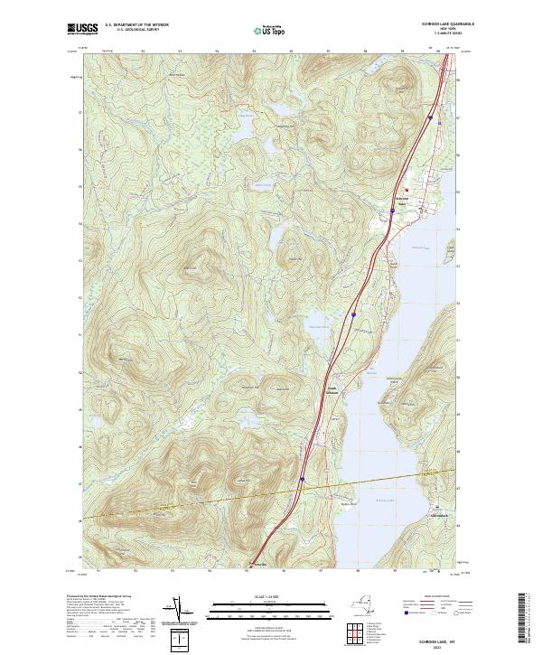
2023 Map of Schroon Lake
USGS Topo · Published 2023About this map
Adirondack Park lands dominate this interior landscape, centered on the expansive waters of Schroon Lake. The settlement patterns recorded here reflect the region's long-standing role as a gateway to the mountains, with the village of Schroon Lake and the smaller community of South Schroon lining the western shore. The map details the transition from the lakeside village atmosphere to the high-elevation terrain of Beech Hill and Hardhack Hill, where logging and recreation trails like the Big Pond Trl and Severance Trl wind through the forest. To the south, Pottersville sits near the crossing of Fuller Brook, while the eastern shore remains less developed, marked by family-named points like Taylors Point and Gull Point. Significant water bodies including Big Pond, Horseshoe Pond, and Thurman Pond are scattered through the hills, feeding the Schroon River system that flows south through The Narrows.
Find a feature on this map
95 named features on this map. Tap any name to fly to it.
Don’t see what you’re looking for? This feature index may not catch every label — zoom into the map to look around manually.
Map Details
Editions of this 2023 Schroon Lake Map
This is the sole edition of this map. No revisions or reprints were ever made.
Other maps of this area

1895 · North Creek
USGS Topo · 1:62,500

1895 · Paradox Lake
USGS Topo · 1:62,500

1897 · Bolton
USGS Topo · 1:62,500

1897 · Paradox Lake
USGS Topo · 1:62,500

1897 · North Creek
USGS Topo · 1:62,500

1897 · Schroon Lake
USGS Topo · 1:62,500

1900 · Bolton
USGS Topo · 1:62,500

1950 · Glens Falls
USGS Topo · 1:250,000
1953 · Paradox Lake
USGS Topo · 1:62,500

1953 · Schroon Lake
USGS Topo · 1:62,500