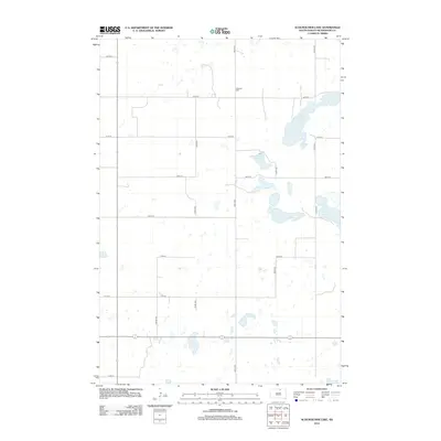
2012 Map of Schumacher Lake
USGS Topo · Published 2012About this map
Schumacher Lake and Long Lake define this high-plains landscape in McPherson County, characterized by a dense network of glacial prairie potholes and seasonal wetlands. The topography is largely organized around a precise sectional grid of gravel roads, including 106th St and 345th Ave, which connect the isolated farmsteads typical of this region. A significant genealogical landmark, the Lutheran Cem, sits near the northern boundary, serving as a quiet witness to the generations of families who have farmed this land. The map illustrates the persistent rural character of South Dakota's northern tier, where the terrain transitions between open grazing land and cultivated fields punctuated by bodies of water like Klooz Lake.
Find a feature on this map
17 named features on this map. Tap any name to fly to it.
Don’t see what you’re looking for? This feature index may not catch every label — zoom into the map to look around manually.
Map Details
Editions of this 2012 Schumacher Lake Map
This is the sole edition of this map. No revisions or reprints were ever made.
Other maps of this area

1954 · Aberdeen
USGS Topo · 1:250,000

1956 · Aberdeen
USGS Topo · 1:250,000

1968 · Long Lake
USGS Topo · 1:24,000

1968 · Long Lake NW
USGS Topo · 1:24,000

1978 · Wolff Lake
USGS Topo · 1:24,000

1978 · Hosmer NW
USGS Topo · 1:24,000

1978 · Hosmer NE
USGS Topo · 1:24,000

1978 · Schumacher Lake
USGS Topo · 1:24,000

1978 · Schumacher Lake SW
USGS Topo · 1:24,000

1978 · Plainview Colony NW
USGS Topo · 1:24,000