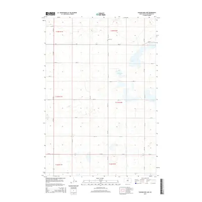
2015 Map of Schumacher Lake
USGS Topo · Published 2015About this map
Schumacher Lake and Long Lake anchor this McPherson County landscape, which is defined by the heavy concentration of glacial potholes and small wetlands characteristic of the Missouri Coteau region. The section-line road network, including 345th Ave and 106th St, reveals the rigid grid of the Public Land Survey System that governs this agricultural prairie. Local history is anchored at the Lutheran Cemetery, situated along the section line between townships t128n r71w and t128n r70w. This 2015 survey illustrates how modern infrastructure, such as 341st Ave, follows the historical paths established by early settlers while preserving the numerous water bodies like Klooz Lake that have dictated the placement of farms and transit routes for generations.
Find a feature on this map
25 named features on this map. Tap any name to fly to it.
Don’t see what you’re looking for? This feature index may not catch every label — zoom into the map to look around manually.
Map Details
Editions of this 2015 Schumacher Lake Map
This is the sole edition of this map. No revisions or reprints were ever made.
Other maps of this area

1954 · Aberdeen
USGS Topo · 1:250,000

1956 · Aberdeen
USGS Topo · 1:250,000

1968 · Long Lake
USGS Topo · 1:24,000

1968 · Long Lake NW
USGS Topo · 1:24,000

1978 · Wolff Lake
USGS Topo · 1:24,000

1978 · Hosmer NW
USGS Topo · 1:24,000

1978 · Hosmer NE
USGS Topo · 1:24,000

1978 · Schumacher Lake
USGS Topo · 1:24,000

1978 · Schumacher Lake SW
USGS Topo · 1:24,000

1978 · Plainview Colony NW
USGS Topo · 1:24,000