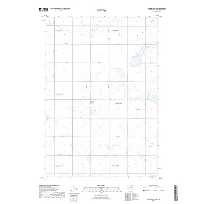
2017 Map of Schumacher Lake
USGS Topo · Published 2017About this map
Glacial depressions and prairie potholes define this section of McPherson County, where the landscape is dotted with numerous small wetlands and larger bodies of water such as Schumacher Lake and Long Lake. The area's settlement history is anchored by its remote burial grounds, including the Bergdorf Cem in the north and the Long Lake Baptist Cem further south. These sites, along with a grid of section-line roads like 341st Ave and 112th St, reflect the enduring agricultural layout of the region. The map captures the interface between these vital water resources and the rural transport network, including Co Hwy 9 and Co Hwy 8, which provide the primary connectivity through this sparsely populated stretch of the Great Plains.
Find a feature on this map
28 named features on this map. Tap any name to fly to it.
Don’t see what you’re looking for? This feature index may not catch every label — zoom into the map to look around manually.
Map Details
Editions of this 2017 Schumacher Lake Map
This is the sole edition of this map. No revisions or reprints were ever made.
Other maps of this area

1954 · Aberdeen
USGS Topo · 1:250,000

1956 · Aberdeen
USGS Topo · 1:250,000

1968 · Long Lake
USGS Topo · 1:24,000

1968 · Long Lake NW
USGS Topo · 1:24,000

1978 · Wolff Lake
USGS Topo · 1:24,000

1978 · Hosmer NW
USGS Topo · 1:24,000

1978 · Hosmer NE
USGS Topo · 1:24,000

1978 · Schumacher Lake
USGS Topo · 1:24,000

1978 · Schumacher Lake SW
USGS Topo · 1:24,000

1978 · Plainview Colony NW
USGS Topo · 1:24,000