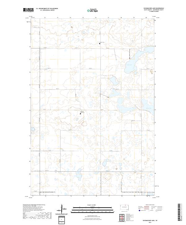
2021 Map of Schumacher Lake
USGS Topo · Published 2021About this map
The quiet, lake-dotted prairies of McPherson County are defined here by a systematic grid of section lines and isolated landmarks of the early settlers. Small, remote burial grounds like Bergdorf Cem and the Long Lake Baptist Cem provide essential anchor points for genealogists researching the area's family histories. The landscape is characterized by numerous prairie potholes and larger water bodies, most notably Long Lake and the smaller Klooz Lake to the east. Transportation through this rural corridor relies on a network of unpaved local roads and county routes, including Co Hwy 8 and Co Hwy 9. This survey captures the enduring agricultural character of the South Dakota plains, where the vastness of the terrain is punctuated only by these occasional markers of community and heritage.
Find a feature on this map
29 named features on this map. Tap any name to fly to it.
Don’t see what you’re looking for? This feature index may not catch every label — zoom into the map to look around manually.
Map Details
Editions of this 2021 Schumacher Lake Map
This is the sole edition of this map. No revisions or reprints were ever made.
Other maps of this area

1954 · Aberdeen
USGS Topo · 1:250,000

1956 · Aberdeen
USGS Topo · 1:250,000

1968 · Long Lake
USGS Topo · 1:24,000

1968 · Long Lake NW
USGS Topo · 1:24,000

1978 · Wolff Lake
USGS Topo · 1:24,000

1978 · Hosmer NW
USGS Topo · 1:24,000

1978 · Hosmer NE
USGS Topo · 1:24,000

1978 · Schumacher Lake
USGS Topo · 1:24,000

1978 · Schumacher Lake SW
USGS Topo · 1:24,000

1978 · Plainview Colony NW
USGS Topo · 1:24,000