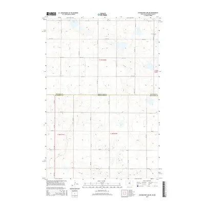
2015 Map of Schumacher Lake NE
USGS Topo · Published 2015About this map
The state boundary between North Dakota and South Dakota bisects this prairie landscape, where the border between McIntosh and McPherson counties follows the same line. The terrain is characterized by a dense network of sectional roads and glacial wetlands, with Tschetter Lake and the winding course of Spring Cr serving as primary landmarks. Near the northern edge of the map, Saint James Cem provides a specific point of interest for genealogists tracing local families in this sparsely settled region. The intersection of modern section lines like 98th St SE with the older Old Sioux Rd in the southeast corner reveals the layer of transit history where established paths met the rigid grid of the Public Land Survey System. This survey documents the persistence of the rural agricultural grid and its scattered water features in the mid-2010s.
Find a feature on this map
30 named features on this map. Tap any name to fly to it.
Don’t see what you’re looking for? This feature index may not catch every label — zoom into the map to look around manually.
Map Details
Editions of this 2015 Schumacher Lake NE Map
This is the sole edition of this map. No revisions or reprints were ever made.
Other maps of this area

1953 · Jamestown
USGS Topo · 1:250,000

1954 · Aberdeen
USGS Topo · 1:250,000

1956 · Aberdeen
USGS Topo · 1:250,000

1956 · Jamestown
USGS Topo · 1:250,000

1968 · Long Lake
USGS Topo · 1:24,000

1968 · Long Lake NW
USGS Topo · 1:24,000

1978 · Wolff Lake
USGS Topo · 1:24,000

1978 · Schumacher Lake
USGS Topo · 1:24,000

1978 · Schumacher Lake SW
USGS Topo · 1:24,000

1978 · Schumacher Lake NE
USGS Topo · 1:24,000