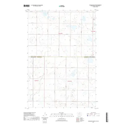
2017 Map of Schumacher Lake NE
USGS Topo · Published 2017About this map
The North Dakota South Dakota border defines this 2017 study, where the plains of McIntosh County meet McPherson County. The landscape is a complex of prairie wetlands and small water bodies, most notably Tschetter Lake in the north and the winding course of Spring Creek in the southwest. Cultural markers are concentrated in the northeastern corner, centered on the Saint James Cemetery, a site of local genealogical significance. The area is traversed by a precise grid of section-line roads, such as 102nd St SE and 342nd Ave, which reveal the enduring structure of Great Plains agricultural surveying. Historical transportation routes are represented by Old Sioux Rd, suggesting the movement through this prairie region prior to the modern highway system, while County Highway 4 serves as a primary east-west artery through the southern township.
Find a feature on this map
21 named features on this map. Tap any name to fly to it.
Don’t see what you’re looking for? This feature index may not catch every label — zoom into the map to look around manually.
Map Details
Editions of this 2017 Schumacher Lake NE Map
This is the sole edition of this map. No revisions or reprints were ever made.
Other maps of this area

1953 · Jamestown
USGS Topo · 1:250,000

1954 · Aberdeen
USGS Topo · 1:250,000

1956 · Aberdeen
USGS Topo · 1:250,000

1956 · Jamestown
USGS Topo · 1:250,000

1968 · Long Lake
USGS Topo · 1:24,000

1968 · Long Lake NW
USGS Topo · 1:24,000

1978 · Wolff Lake
USGS Topo · 1:24,000

1978 · Schumacher Lake
USGS Topo · 1:24,000

1978 · Schumacher Lake SW
USGS Topo · 1:24,000

1978 · Schumacher Lake NE
USGS Topo · 1:24,000