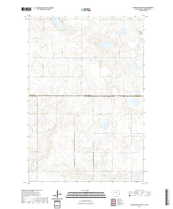
2021 Map of Schumacher Lake NE
USGS Topo · Published 2021About this map
Saint James Cem sits near the eastern edge of this landscape, marking a quiet point of record in the prairie of the North Dakota and South Dakota borderlands. The terrain is defined by the subtle drainage patterns of Spring Cr, which meanders through the southwestern reaches, and the presence of glacial depressions like Schetter Lake to the north. This 2021 survey reveals a region structured by a rigid section-line road network, including historic routes such as Old Sioux Rd. The intersection of Co Hwy 4 and various numbered avenues provides the primary framework for the scattered homesteads and agricultural operations across McIntosh and McPherson counties. The map illustrates a contemporary view of this remote boundary area, where the vast open lands are segmented by county roads that follow the legacy of the Public Land Survey System.
Find a feature on this map
32 named features on this map. Tap any name to fly to it.
Don’t see what you’re looking for? This feature index may not catch every label — zoom into the map to look around manually.
Map Details
Editions of this 2021 Schumacher Lake NE Map
This is the sole edition of this map. No revisions or reprints were ever made.
Other maps of this area

1953 · Jamestown
USGS Topo · 1:250,000

1954 · Aberdeen
USGS Topo · 1:250,000

1956 · Aberdeen
USGS Topo · 1:250,000

1956 · Jamestown
USGS Topo · 1:250,000

1968 · Long Lake
USGS Topo · 1:24,000

1968 · Long Lake NW
USGS Topo · 1:24,000

1978 · Wolff Lake
USGS Topo · 1:24,000

1978 · Schumacher Lake
USGS Topo · 1:24,000

1978 · Schumacher Lake SW
USGS Topo · 1:24,000

1978 · Schumacher Lake NE
USGS Topo · 1:24,000