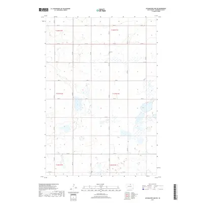
2017 Map of Schumacher Lake SW
USGS Topo · Published 2017About this map
Small rural burying grounds and a dense network of sectional roads define this portion of McPherson County in 2017. Glueckstahl Cem sits near the intersection of 338th Ave and 107th St, while Calvin Cem is located further south along 113th St. The landscape is dominated by numerous small water bodies and seasonal wetlands, illustrating the prairie pothole geography characteristic of the region. Transportation across the township lines of t127n r71w and its neighbors relies on a grid of gravel roads and the paved corridor of Co Hwy 8. This modern survey provides a clear view of the land divisions and remaining pioneer-era landmarks that anchor the local community history in a sparsely populated agricultural environment.
Find a feature on this map
22 named features on this map. Tap any name to fly to it.
Don’t see what you’re looking for? This feature index may not catch every label — zoom into the map to look around manually.
Map Details
Editions of this 2017 Schumacher Lake SW Map
This is the sole edition of this map. No revisions or reprints were ever made.
Other maps of this area

1954 · Aberdeen
USGS Topo · 1:250,000

1956 · Aberdeen
USGS Topo · 1:250,000

1978 · Wolff Lake
USGS Topo · 1:24,000

1978 · Hosmer NW
USGS Topo · 1:24,000

1978 · Hosmer NE
USGS Topo · 1:24,000

1978 · Venturia
USGS Topo · 1:24,000

1978 · Eureka East
USGS Topo · 1:24,000

1978 · Schumacher Lake
USGS Topo · 1:24,000

1978 · Schumacher Lake SW
USGS Topo · 1:24,000
1978 · Hillsview
USGS Topo · 1:24,000