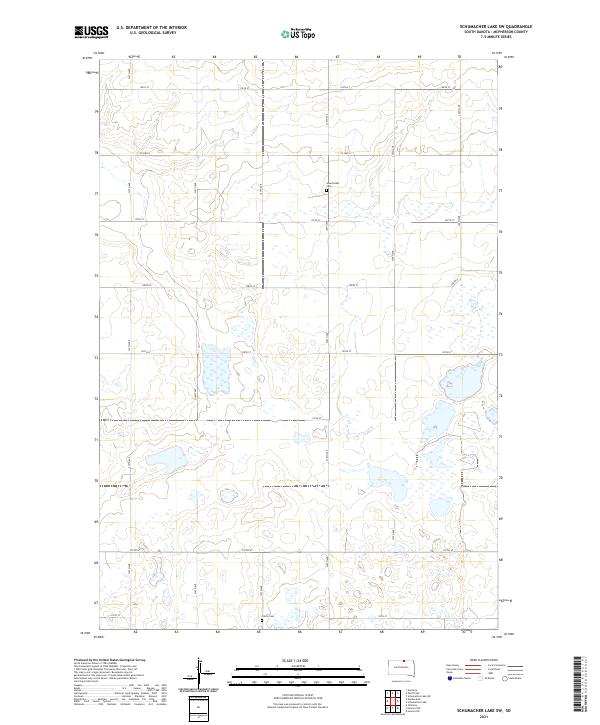
2021 Map of Schumacher Lake SW
USGS Topo · Published 2021About this map
Glacial depressions and small prairie potholes define this landscape in McPherson County, where the topography is shaped by the subtle rise and fall of the northern Great Plains. Settlement patterns are sparse, dictated by the Section-Township-Range system of the Public Land Survey System, with roads like 338th Ave and Co Hwy 8 following the rigid mile-grid of the rural countryside. Historical traces of early families are preserved in small rural burial grounds such as Glueckstahl Cem and Calvin Cem, which stand as quiet landmarks amidst the surrounding agricultural fields and wetlands. The lack of concentrated towns highlights the importance of these local heritage sites for genealogical research in this part of South Dakota.
Find a feature on this map
22 named features on this map. Tap any name to fly to it.
Don’t see what you’re looking for? This feature index may not catch every label — zoom into the map to look around manually.
Map Details
Editions of this 2021 Schumacher Lake SW Map
This is the sole edition of this map. No revisions or reprints were ever made.
Other maps of this area

1954 · Aberdeen
USGS Topo · 1:250,000

1956 · Aberdeen
USGS Topo · 1:250,000

1978 · Wolff Lake
USGS Topo · 1:24,000

1978 · Hosmer NW
USGS Topo · 1:24,000

1978 · Hosmer NE
USGS Topo · 1:24,000

1978 · Venturia
USGS Topo · 1:24,000

1978 · Eureka East
USGS Topo · 1:24,000

1978 · Schumacher Lake
USGS Topo · 1:24,000

1978 · Schumacher Lake SW
USGS Topo · 1:24,000
1978 · Hillsview
USGS Topo · 1:24,000