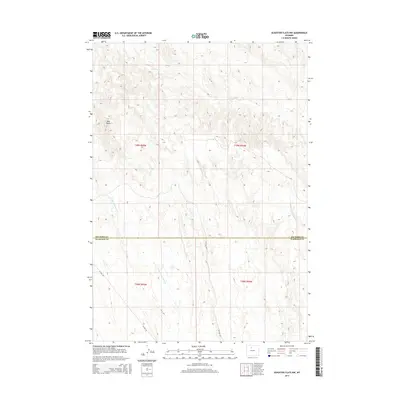
2015 Map of Schuster Flats NW
USGS Topo · Published 2015About this map
Red Butte stands as a prominent landmark in this section of the Bighorn Basin, where the landscape is defined by the complex drainage systems of the arid plains. The survey illustrates the divide between the north and middle forks of the Fifteenmile Creek system, with N Fork Fifteenmile Cr and Middle Fork Fifteenmile Cr carving distinct paths through the terrain. To the north, Fivemile Cr winds through the township, marking a separate hydrologic drainage. The road network is sparse but functional, centered on long-distance routes like 15 Mile Rd and Ten Mile Rd, which follow the section lines of the Public Land Survey System. Straddling the border between Big Horn and Washakie counties, the map documents the intersection of T48N and T49N, providing a clear record of the area's geography and administrative boundaries in the mid-2010s.
Find a feature on this map
11 named features on this map. Tap any name to fly to it.
Don’t see what you’re looking for? This feature index may not catch every label — zoom into the map to look around manually.
Map Details
Editions of this 2015 Schuster Flats NW Map
This is the sole edition of this map. No revisions or reprints were ever made.
Other maps of this area

1951 · Sucker Dam
USGS Topo · 1:24,000

1951 · Schuster Flats NE
USGS Topo · 1:24,000

1951 · Dutch Nick Flat
USGS Topo · 1:24,000

1951 · Schuster Flats
USGS Topo · 1:24,000

1951 · Schuster Flats NW
USGS Topo · 1:24,000

1951 · Schuster Flats SE
USGS Topo · 1:24,000

1951 · Wardel Reservoir
USGS Topo · 1:24,000

1955 · Cody
USGS Topo · 1:250,000

1958 · Cody
USGS Topo · 1:250,000

1962 · Cody
USGS Topo · 1:250,000