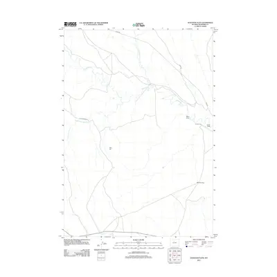
2012 Map of Schuster Flats
USGS Topo · Published 2012About this map
Fifteenmile Cr and its various forks define the drainage patterns of this high plains landscape in Washakie County. The map shows a region shaped by ranching and energy infrastructure, evidenced by the Murdoch Cabin near the eastern edge and the prominent Platte Pipeline Rd traversing the terrain. The expansive Schuster Flats occupies much of the southeastern quadrant, while significant landmarks like Red Hill provide vertical relief in an otherwise sweeping landscape of draws and creeks. At the southern border, the Holland Ditch suggests the vital role of water management and irrigation in this arid environment. This 2012 survey by the U. S. Geological Survey serves as a detailed record of local access routes like 15 Mile Rd and 10 Mile Rd, which connect the isolated homesteads and industrial sites across the basin.
Find a feature on this map
13 named features on this map. Tap any name to fly to it.
Don’t see what you’re looking for? This feature index may not catch every label — zoom into the map to look around manually.
Map Details
Editions of this 2012 Schuster Flats Map
This is the sole edition of this map. No revisions or reprints were ever made.
Other maps of this area

1914 · Blue Mesa
USGS Topo · 1:62,500

1916 · Blue Mesa
USGS Topo · 1:62,500

1945 · Kirby
USGS Topo · 1:62,500

1946 · Kirby
USGS Topo · 1:62,500

1951 · Sucker Dam
USGS Topo · 1:24,000

1951 · Schuster Flats NE
USGS Topo · 1:24,000

1951 · Dutch Nick Flat
USGS Topo · 1:24,000

1951 · Schuster Flats
USGS Topo · 1:24,000

1951 · Schuster Flats NW
USGS Topo · 1:24,000

1951 · Schuster Flats SE
USGS Topo · 1:24,000