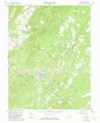
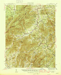
1967 Map of Schuyler
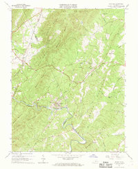
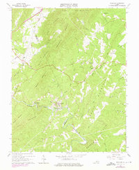
USGS Topo · Published 1982About this map
Schuyler sits at the heart of this landscape, its industrial character defined by the Quarry and nearby rail connections along the Rockfish River. The terrain is dominated by a series of prominent ridges, including Brush Mountain, Appleberry Mountain, and Shiloh Mountain, which separate small agricultural and timber clearings. A heavy concentration of country churches, such as Rock Springs Ch, Mt Shiloh Ch, and Oak Ridge Ch, indicates the established community networks of the mid-20th century.
Find a feature on this map
54 named features on this map. Tap any name to fly to it.
Don’t see what you’re looking for? This feature index may not catch every label — zoom into the map to look around manually.
Map Details
Editions of this 1967 Schuyler Map
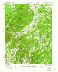
Other maps of this area

1892 · Buckingham
USGS Topo · 1:125,000

1929 · Covesville
USGS Topo · 1:62,500

1935 · Covesville
USGS Topo · 1:62,500
1943 · Lovingston
USGS Topo · 1:62,500

1945 · Covesville
USGS Topo · 1:62,500
1946 · Lovingston
USGS Topo · 1:62,500

1947 · Roanoke
USGS Topo · 1:250,000

1959 · Roanoke
USGS Topo · 1:250,000
1961 · Shipman
USGS Topo · 1:62,500

1961 · Buckingham
USGS Topo · 1:62,500