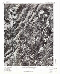
1979 Map of Schuyler
USGS Topo · Published 1982About this map
Schuyler serves as the central hub of this 1979 orthophotoquad, which captures the Piedmont transition of Nelson County using aerial photography. This specific format, produced in cooperation with the Soil Conservation Service, provides a literal photographic view of the land use patterns and forest cover in Virginia during the late 1970s. The winding course of the Rockfish River carves through the southern portion of the sheet, while several smaller settlements including Faber, Damon, and Mt Alto are visible along the established road corridors.
Find a feature on this map
10 named features on this map. Tap any name to fly to it.
Don’t see what you’re looking for? This feature index may not catch every label — zoom into the map to look around manually.
Map Details
Editions of this 1979 Schuyler Map
This is the sole edition of this map. No revisions or reprints were ever made.
Other maps of this area

1892 · Buckingham
USGS Topo · 1:125,000

1929 · Covesville
USGS Topo · 1:62,500

1935 · Covesville
USGS Topo · 1:62,500

1943 · Lovingston
USGS Topo · 1:62,500

1945 · Covesville
USGS Topo · 1:62,500

1946 · Lovingston
USGS Topo · 1:62,500

1947 · Roanoke
USGS Topo · 1:250,000

1959 · Roanoke
USGS Topo · 1:250,000

1961 · Shipman
USGS Topo · 1:62,500

1961 · Buckingham
USGS Topo · 1:62,500