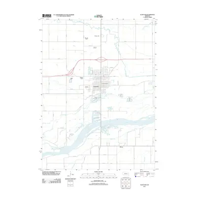
2011 Map of Schuyler
USGS Topo · Published 2011About this map
Schuyler serves as the central hub of this Nebraska landscape, situated between the winding course of Shell Creek to the north and the wide braids of the Platte River to the south. This 2011 survey documents the town's modern footprint, including residential expansions like Sunset Acres and the civic importance of the Schuyler Post Office. The surrounding terrain is marked by significant watercourses, including Lost Creek, which meanders through the farmland south of the city center.
Find a feature on this map
40 named features on this map. Tap any name to fly to it.
Don’t see what you’re looking for? This feature index may not catch every label — zoom into the map to look around manually.
Map Details
Editions of this 2011 Schuyler Map
This is the sole edition of this map. No revisions or reprints were ever made.
Other maps of this area

1899 · Wahoo
USGS Topo · 1:125,000

1899 · David City
USGS Topo · 1:125,000

1955 · Fremont
USGS Topo · 1:250,000

1957 · Fremont
USGS Topo · 1:250,000

1958 · Fremont
USGS Topo · 1:250,000

1966 · Clarkson SW
USGS Topo · 1:24,000

1966 · Dodge SW
USGS Topo · 1:24,000
1966 · Clarkson SE
USGS Topo · 1:24,000

1968 · Bruno
USGS Topo · 1:24,000
1968 · David City West
USGS Topo · 1:24,000