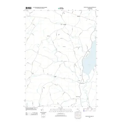
2013 Map of Schuyler Lake
USGS Topo · Published 2013About this map
Canadarago Lake dominates the eastern edge of this Otsego County landscape, where the waters flow south through Oaks Cr. The settlement of Schuyler Lake serves as a local hub, featuring its own Schuyler Lake Cem and a central Po. The surrounding terrain is defined by a network of rural crossroads and family-named elevations like Angel Hill and Hawk Hill. Small, dispersed communities such as Exeter Corner, Lidell Corners, and the curiously named Dogtown are connected by a web of county highways and winding local roads like No Mans Land Rd and Angel Hill Rd. Numerous burial grounds, including Twilight Rest Cem and Herkimer Cem, offer valuable data points for genealogists tracing long-established families in the region. The map also captures the intricate drainage patterns of the Upper Susquehanna watershed, with Wharton Cr and Butternut Cr carving through the hills west of the lake.
Find a feature on this map
79 named features on this map. Tap any name to fly to it.
Don’t see what you’re looking for? This feature index may not catch every label — zoom into the map to look around manually.
Map Details
Editions of this 2013 Schuyler Lake Map
This is the sole edition of this map. No revisions or reprints were ever made.
Other maps of this area

1903 · Richfield Springs
USGS Topo · 1:62,500

1907 · Winfield
USGS Topo · 1:62,500

1907 · Cooperstown
USGS Topo · 1:62,500

1909 · Cooperstown
USGS Topo · 1:62,500

1910 · Hartwick
USGS Topo · 1:62,500

1912 · Hartwick
USGS Topo · 1:62,500

1943 · Schuyler Lake
USGS Topo · 1:24,000

1943 · Jordanville
USGS Topo · 1:24,000

1943 · Richfield Springs
USGS Topo · 1:24,000

1943 · Millers Mills
USGS Topo · 1:24,000