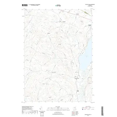
2019 Map of Schuyler Lake
USGS Topo · Published 2019About this map
Canadarago Lake dominates the eastern edge of this landscape, its western shores traced by Woodland Rd and Walters Way. To the west, the terrain rises into a series of named summits including Gunset Hill, Nine Hill, and the notably steep Panther Mtn. The settlement pattern centers on small historical hamlets like Schuyler Lake, Exeter Corner, and Lidell Corners, connected by a network of drainage systems such as Hyder Cr and Herkimer Cr. Local history is preserved in several rural burial grounds, from the Twilight Rest Cem near Richfield to the Exeter Cem on the high ground south of Dogtown. The boundary between Herkimer and Otsego counties cuts across the northern reaches, marking a transition between the northern hills and the lake-oriented communities of the southern quadrangle.
Find a feature on this map
82 named features on this map. Tap any name to fly to it.
Don’t see what you’re looking for? This feature index may not catch every label — zoom into the map to look around manually.
Map Details
Editions of this 2019 Schuyler Lake Map
This is the sole edition of this map. No revisions or reprints were ever made.
Other maps of this area

1903 · Richfield Springs
USGS Topo · 1:62,500

1907 · Winfield
USGS Topo · 1:62,500

1907 · Cooperstown
USGS Topo · 1:62,500

1909 · Cooperstown
USGS Topo · 1:62,500

1910 · Hartwick
USGS Topo · 1:62,500

1912 · Hartwick
USGS Topo · 1:62,500

1943 · Schuyler Lake
USGS Topo · 1:24,000

1943 · Jordanville
USGS Topo · 1:24,000

1943 · Richfield Springs
USGS Topo · 1:24,000

1943 · Millers Mills
USGS Topo · 1:24,000