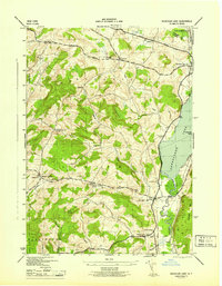
1945 Map of Schuyler Lake
USGS Topo · Published 1945About this map
Canadarago Lake and its northern outflow dominate the eastern portion of this mid-century survey of Otsego County. The landscape is characterized by its early transport corridors, including the Skaneateles Turnpike and the Cherry Valley Turnpike, alongside the tracks of the D L & W RR passing through Richfield Springs. Rural education and community life are well-documented through numerous district facilities like Cobblestone Sch, Ryder Sch, and School No 5.
Find a feature on this map
42 named features on this map. Tap any name to fly to it.
Don’t see what you’re looking for? This feature index may not catch every label — zoom into the map to look around manually.
Map Details
Editions of this 1945 Schuyler Lake Map
This is the sole edition of this map. No revisions or reprints were ever made.
Other maps of this area

1903 · Richfield Springs
USGS Topo · 1:62,500

1907 · Winfield
USGS Topo · 1:62,500

1907 · Cooperstown
USGS Topo · 1:62,500

1909 · Cooperstown
USGS Topo · 1:62,500

1910 · Hartwick
USGS Topo · 1:62,500

1912 · Hartwick
USGS Topo · 1:62,500

1943 · Schuyler Lake
USGS Topo · 1:24,000

1943 · Jordanville
USGS Topo · 1:24,000

1943 · Richfield Springs
USGS Topo · 1:24,000

1943 · Millers Mills
USGS Topo · 1:24,000