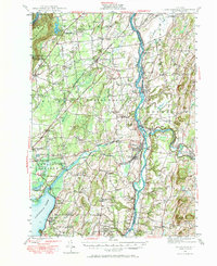
1947 Map of Schuylerville
USGS Topo · Published 1966About this map
The Hudson River corridor near Schuylerville reflects a landscape deeply intertwined with early American industrial and military history. In the years following World War II, the region maintained its network of small crossroads settlements like Gansevoort, Northumberland, and Middle Falls. The transportation evolution of the valley is clearly marked by the parallel paths of the active Champlain Canal and the Old Champlain Canal (Abandoned), which once powered the local river economy. To the south, the Saratoga Monument and the Saratoga National Historical Park anchor the map, preserving the grounds of the 1777 Revolutionary War victory. Along the western edge, the Palmertown Range rises toward Mount McGregor, which hosted the New York State Veterans Hospital, while the lower lands are dotted with numerous numbered district schools and family-linked corners such as Dimmick Corners and Ballard Corners.
Find a feature on this map
112 named features on this map. Tap any name to fly to it.
Don’t see what you’re looking for? This feature index may not catch every label — zoom into the map to look around manually.
Map Details
Editions of this 1947 Schuylerville Map
3 editions found
Other maps of this area

1893 · Cohoes
USGS Topo · 1:62,500

1893 · Schenectady
USGS Topo · 1:62,500

1893 · Fort Ann
USGS Topo · 1:62,500

1895 · Cohoes
USGS Topo · 1:62,500

1895 · Cambridge
USGS Topo · 1:62,500

1895 · Fort Ann
USGS Topo · 1:62,500

1895 · Schenectady
USGS Topo · 1:62,500

1895 · Glens Falls
USGS Topo · 1:62,500

1897 · Glens Falls
USGS Topo · 1:62,500

1897 · Hoosick
USGS Topo · 1:62,500