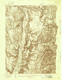
1935 Map of Schuylerville
USGS Topo · Published 1935About this map
The Hudson River corridor near Schuylerville and Greenwich is captured here during the mid-1930s, showcasing a landscape transitioning from its industrial and canal-era peak. The dominance of the river is clear, with the Champlain Canal (Abandoned) tracing the western bank, a reminder of the earlier transportation network that shaped these river towns. To the south, the Saratoga Battlefield and the Saratoga Battle Monument mark the significant revolutionary history of this ground.
Find a feature on this map
47 named features on this map. Tap any name to fly to it.
Don’t see what you’re looking for? This feature index may not catch every label — zoom into the map to look around manually.
Map Details
Editions of this 1935 Schuylerville Map
This is the sole edition of this map. No revisions or reprints were ever made.
Other maps of this area

1893 · Cohoes
USGS Topo · 1:62,500

1895 · Cohoes
USGS Topo · 1:62,500

1895 · Cambridge
USGS Topo · 1:62,500

1897 · Hoosick
USGS Topo · 1:62,500

1898 · Cambridge
USGS Topo · 1:62,500

1898 · Cohoes
USGS Topo · 1:62,500

1900 · Taconic
USGS Topo · 1:125,000

1900 · Schuylerville
USGS Topo · 1:62,500

1901 · Cambridge
USGS Topo · 1:62,500

1903 · Mettawee
USGS Topo · 1:125,000