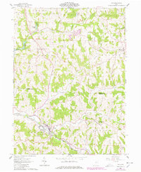
2023 Map of Scio
USGS Topo · Published 2023About this map
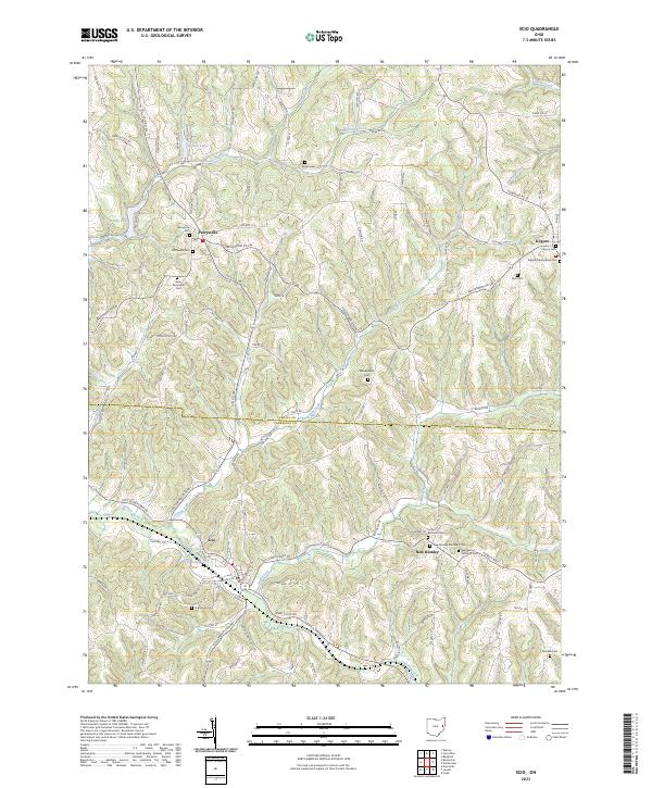
Scio and the surrounding borderlands of Carroll and Harrison Counties are defined by a network of steep ridges and winding creek valleys. This 2023 survey documents the modern layout of several early Ohio settlements, including New Rumley and Kilgore. The landscape is dotted with numerous small family and community burial grounds, such as Arabia Cem and the Woodpecker Cem, providing a detailed record for genealogical research. Water features like Scio Pottery Pond, Stony Lake, and Vo Ash Lake sit among the hills, while the Dining Fork and McGuire Creek carve the primary drainage patterns through the terrain. A dense web of rural routes, such as the Scio Carrollton Rd and Amsterdam Rd SW, connects these dispersed communities across the township lines.
Find a feature on this map
53 named features on this map. Tap any name to fly to it.
Don’t see what you’re looking for? This feature index may not catch every label — zoom into the map to look around manually.
Map Details
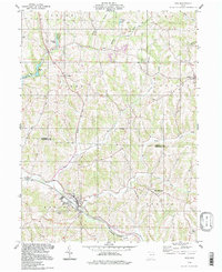
Editions of this 2023 Scio Map
This is the sole edition of this map. No revisions or reprints were ever made.
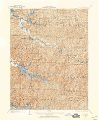
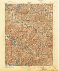
Historical Maps of New Rumley Through Time
5 maps found