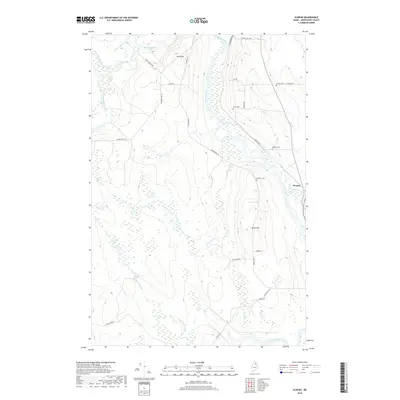
2018 Map of Scopan
USGS Topo · Published 2018About this map
The Aroostook River winds through this northern Maine landscape, defining a region characterized by its expansive waterways and rural road networks. Near the settlement of Scopan, the confluence with Scopan Stream highlights a geography deeply tied to the river's path. The area is dotted with small family and community burial grounds, including the Winslow Cem, Alieff Cem, Rafford Cem, and Robinson Cem, providing specific points of interest for genealogical research. Prominent elevations like Young Hill and Grove Hill overlook the valleys of the Machias River and Shields Brook. The presence of numerous secondary roads such as Lynchs Tote Rd and State Farm Rd indicates a landscape shaped by both timber and agriculture, offering a clear view of the land-use patterns in this part of Aroostook County during the early 21st century.
Find a feature on this map
30 named features on this map. Tap any name to fly to it.
Don’t see what you’re looking for? This feature index may not catch every label — zoom into the map to look around manually.
Map Details
Editions of this 2018 Scopan Map
This is the sole edition of this map. No revisions or reprints were ever made.
Other maps of this area

1930 · Greenlaw
USGS Topo · 1:48,000

1931 · Ashland
USGS Topo · 1:48,000

1933 · Greenlaw
USGS Topo · 1:62,500

1934 · Ashland
USGS Topo · 1:62,500

1940 · Oxbow
USGS Topo · 1:62,500

1942 · Oxbow
USGS Topo · 1:62,500

1953 · Ashland
USGS Topo · 1:62,500

1954 · Grand Lake Seboeis
USGS Topo · 1:62,500

1954 · Presque Isle
USGS Topo · 1:250,000

1958 · Presque Isle
USGS Topo · 1:250,000