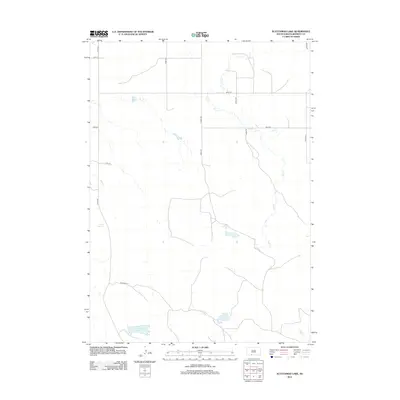
2012 Map of Scotchman Lake
USGS Topo · Published 2012About this map
Scotchman Lake anchors the southern portion of this high plains landscape in Bennett County. The terrain is defined by the subtle drainage patterns of Peck Cr and Hay Cr, illustrating the sparse water resources characteristic of this part of South Dakota. Human impact is primarily visible through a rigid grid of section-line roads, including 231st Ave and 297th St, which facilitate access to the surrounding ranching and agricultural lands. The presence of Rose Springs provides a rare point of natural interest in an area where local travel is managed via uniquely named routes such as Ringneck Ln and Swan Rd. This document serves as a detailed record of the region's rural infrastructure and hydrology in the early twenty-first century.
Find a feature on this map
16 named features on this map. Tap any name to fly to it.
Don’t see what you’re looking for? This feature index may not catch every label — zoom into the map to look around manually.
Map Details
Editions of this 2012 Scotchman Lake Map
This is the sole edition of this map. No revisions or reprints were ever made.
Other maps of this area

1951 · Merriman
USGS Topo · 1:62,500

1952 · Eli
USGS Topo · 1:62,500

1955 · Martin
USGS Topo · 1:250,000

1957 · Valentine
USGS Topo · 1:250,000

1958 · Martin
USGS Topo · 1:250,000

1959 · Valentine
USGS Topo · 1:250,000

1981 · Phantom Lake
USGS Topo · 1:25,000

1981 · Martin
USGS Topo · 1:25,000

1981 · Scotchman Lake
USGS Topo · 1:25,000

1981 · Tuthill
USGS Topo · 1:25,000