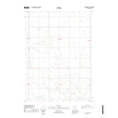
2017 Map of Scotchman Lake
USGS Topo · Published 2017About this map
Scotchman Lake and the surrounding high plains of Bennett County appear in this 2017 survey, characterized by the intricate drainage systems of Peck Cr and Hay Cr. The landscape is defined by its seasonal wetlands and ephemeral water bodies, which are critical features in this semi-arid region. These hydraulic patterns, combined with landmarks like Rose Springs, illustrate the historical reliance on reliable water sources in a territory structured by the Public Land Survey System. Movement through this portion of South Dakota is facilitated by a grid of rural routes, including the Tuthill-Eli Rd and Eli Rd, which follow the section lines of Township 36 North and Township 35 North. The map reveals the sparsely populated, open-range character of the region, where roads like 298 St provide the primary links between isolated ranching lands and the natural topography.
Find a feature on this map
12 named features on this map. Tap any name to fly to it.
Don’t see what you’re looking for? This feature index may not catch every label — zoom into the map to look around manually.
Map Details
Editions of this 2017 Scotchman Lake Map
This is the sole edition of this map. No revisions or reprints were ever made.
Other maps of this area

1951 · Merriman
USGS Topo · 1:62,500

1952 · Eli
USGS Topo · 1:62,500

1955 · Martin
USGS Topo · 1:250,000

1957 · Valentine
USGS Topo · 1:250,000

1958 · Martin
USGS Topo · 1:250,000

1959 · Valentine
USGS Topo · 1:250,000

1981 · Phantom Lake
USGS Topo · 1:25,000

1981 · Martin
USGS Topo · 1:25,000

1981 · Scotchman Lake
USGS Topo · 1:25,000

1981 · Tuthill
USGS Topo · 1:25,000