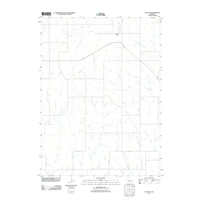
2011 Map of Scotia NE
USGS Topo · Published 2011About this map
Boston Valley sits at the northern edge of this Greeley County landscape, where the agricultural grid of the Nebraska plains is defined by a network of seasonal watercourses and rural thoroughfares. The drainage pattern is dominated by southward-flowing streams including Fish Creek, Moffet Creek, and the winding Dry Creek, which cut through the section lines. This 2011 survey documents the persistent rural character of the region, anchored by established routes such as Greeley Ave and the descriptively named Deadwood Trl. The map illustrates how local topography influenced the placement of roads like Page Rd and Liberty Rd, providing a clear view of land divisions and property access in the early 21st century. The prominent West Branch Spring Creek in the northeast corner further illustrates the importance of these small riparian corridors to the local geography.
Find a feature on this map
13 named features on this map. Tap any name to fly to it.
Don’t see what you’re looking for? This feature index may not catch every label — zoom into the map to look around manually.
Map Details
Editions of this 2011 Scotia NE Map
This is the sole edition of this map. No revisions or reprints were ever made.
Other maps of this area

1899 · Loup
USGS Topo · 1:125,000

1899 · St. Paul
USGS Topo · 1:125,000

1953 · Cotesfield
USGS Topo · 1:24,000

1953 · Scotia NE
USGS Topo · 1:24,000

1953 · Scotia
USGS Topo · 1:24,000

1953 · Elba
USGS Topo · 1:24,000

1954 · Horace
USGS Topo · 1:24,000

1954 · Greeley
USGS Topo · 1:24,000

1954 · Spalding SW
USGS Topo · 1:24,000

1954 · Wolbach
USGS Topo · 1:24,000