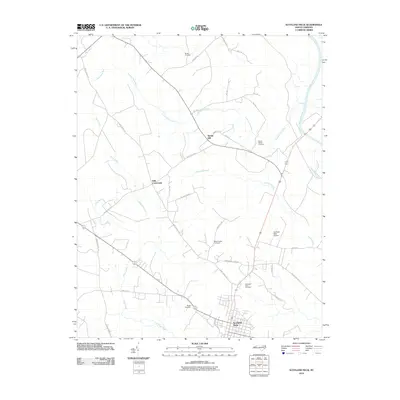
2010 Map of Scotland Neck
USGS Topo · Published 2010About this map
Scotland Neck serves as the primary hub in this corner of North Carolina, where the coastal plain begins its slow transition toward the Roanoke River. The landscape is defined by its drainages and lowlands, most notably the wide expanse of Kehukee Swamp and the winding course of Looking Glass Run and Deep Creek. This area maintains a strong agricultural and rural character, with smaller settlements like Spring Hill and Hills Crossroads connected by a network of named country roads such as Mary Chapel Rd and Pittman Town Rd. Genealogists will find a high density of burial sites across the township, including Shields Cemetery, Madry Cemetery, and the Scotland Neck Cemetery. The infrastructure of the early 21st century is represented by the Scotland Neck Airport and the persistent path of Bakers School Rd, reflecting a community deeply tied to its geography and history.
Find a feature on this map
27 named features on this map. Tap any name to fly to it.
Don’t see what you’re looking for? This feature index may not catch every label — zoom into the map to look around manually.
Map Details
Editions of this 2010 Scotland Neck Map
This is the sole edition of this map. No revisions or reprints were ever made.
Other maps of this area

1953 · Norfolk
USGS Topo · 1:250,000

1960 · Dawson Crossroads
USGS Topo · 1:24,000

1960 · Draughn
USGS Topo · 1:24,000

1962 · Palmyra
USGS Topo · 1:24,000

1962 · Scotland Neck
USGS Topo · 1:24,000

1962 · Norfleet
USGS Topo · 1:24,000

1962 · Hobgood
USGS Topo · 1:24,000

1974 · Halifax
USGS Topo · 1:24,000

1974 · Boones Crossroads
USGS Topo · 1:24,000

1974 · Rich Square
USGS Topo · 1:24,000