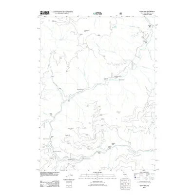
2012 Map of Scott Bar
USGS Topo · Published 2012About this map
The Scott River carves a deep path through this Klamath National Forest landscape, anchoring the historic community of Scott Bar. The map illustrates a region defined by its narrow river corridors and high summits, including Tom Martin Peak and Anderson Peak. Settlement patterns remain concentrated along the riverbanks at locations like Gold Flat and numerous developed recreation sites such as Indian Scotty Campground and Spring Flat Campground. Transportation in the area relies heavily on Scott River Rd, which follows the water's winding course. Notable landmarks of local management and history include the Scott Bar Lookout and the Scott River Holding Corral. The terrain is marked by numerous named gulches and flats, such as Swanson Gulch and Beauty Flat, reflecting a long history of local naming conventions tied to the area's geography and early inhabitants.
Find a feature on this map
42 named features on this map. Tap any name to fly to it.
Don’t see what you’re looking for? This feature index may not catch every label — zoom into the map to look around manually.
Map Details
Editions of this 2012 Scott Bar Map
This is the sole edition of this map. No revisions or reprints were ever made.
Other maps of this area

1886 · Shasta
USGS Topo · 1:250,000

1894 · Shasta
USGS Topo · 1:250,000

1914 · Seiad
USGS Topo · 1:125,000

1922 · Seiad
USGS Topo · 1:125,000

1932 · Yreka
USGS Topo · 1:96,000

1939 · Yreka
USGS Topo · 1:125,000

1948 · Weed
USGS Topo · 1:250,000

1950 · Weed
USGS Topo · 1:250,000

1955 · Seiad Valley
USGS Topo · 1:62,500

1955 · Condrey Mtn
USGS Topo · 1:62,500