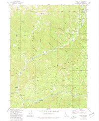
1980 Map of Scott Bar
USGS Topo · Published 1980About this map
The Scott River carves a deep path through northern Siskiyou County, defining the corridor between the Marble Mountains and the Scott Bar Mountains. The settlement at Scott Bar serves as a focal point for the region, complete with a Forest Service Sta and a Historical Marker noting the area's significance. This landscape is a working mountain environment, where resource extraction and recreation coexist within the Klamath National Forest.
Find a feature on this map
53 named features on this map. Tap any name to fly to it.
Don’t see what you’re looking for? This feature index may not catch every label — zoom into the map to look around manually.
Map Details
Editions of this 1980 Scott Bar Map
This is the sole edition of this map. No revisions or reprints were ever made.
Other maps of this area

1886 · Shasta
USGS Topo · 1:250,000

1894 · Shasta
USGS Topo · 1:250,000

1914 · Seiad
USGS Topo · 1:125,000

1922 · Seiad
USGS Topo · 1:125,000

1932 · Yreka
USGS Topo · 1:96,000

1939 · Yreka
USGS Topo · 1:125,000

1948 · Weed
USGS Topo · 1:250,000

1950 · Weed
USGS Topo · 1:250,000

1955 · Seiad Valley
USGS Topo · 1:62,500

1955 · Condrey Mtn
USGS Topo · 1:62,500