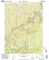
2001 Map of Scott Bar
USGS Topo · Published 2004About this map
Scott Bar sits at the confluence of the Scott River and the Klamath River, serving as a focal point for this rugged section of Siskiyou County. The map reveals the dramatic topography of the Marble Mountains and the Scott Bar Mountains, where numerous gulches like Swanson Gulch and Schuler Gulch drain into the primary river systems. This 2001 revision illustrates a landscape managed for both preservation and utility, evidenced by the Klamath National Forest boundary and infrastructure such as the Scott River Holding Corral and a Ranger Station.
Find a feature on this map
46 named features on this map. Tap any name to fly to it.
Don’t see what you’re looking for? This feature index may not catch every label — zoom into the map to look around manually.
Map Details
Editions of this 2001 Scott Bar Map
This is the sole edition of this map. No revisions or reprints were ever made.
Other maps of this area

1886 · Shasta
USGS Topo · 1:250,000

1894 · Shasta
USGS Topo · 1:250,000

1914 · Seiad
USGS Topo · 1:125,000

1922 · Seiad
USGS Topo · 1:125,000

1932 · Yreka
USGS Topo · 1:96,000

1939 · Yreka
USGS Topo · 1:125,000

1948 · Weed
USGS Topo · 1:250,000

1950 · Weed
USGS Topo · 1:250,000

1955 · Seiad Valley
USGS Topo · 1:62,500

1955 · Condrey Mtn
USGS Topo · 1:62,500