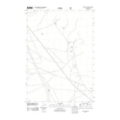
2011 Map of Scott Butte
USGS Topo · Published 2011About this map
Scott Butte stands as a prominent landmark in this eastern Idaho landscape, overlooking a series of dramatic drainages and early irrigation efforts. The map reveals the intricate network of canyons including Spring Canyon, Bloom Canyon, and Deadman Canyon that feed into the broader basin. In the south, the Birch Creek Valley is a focal point for water management, featuring both the natural course of Birch Creek and the man-made Reno Ditch. The presence of Reno Point and the alignment of Scott Butte Rd suggest the historical and continued importance of this corridor for access and ranching. The cartography traces the essential relationship between the high desert terrain and the vital water sources that have shaped land use in Clark County.
Find a feature on this map
17 named features on this map. Tap any name to fly to it.
Don’t see what you’re looking for? This feature index may not catch every label — zoom into the map to look around manually.
Map Details
Editions of this 2011 Scott Butte Map
This is the sole edition of this map. No revisions or reprints were ever made.
Other maps of this area

1955 · Dubois
USGS Topo · 1:250,000

1955 · Idaho Falls
USGS Topo · 1:250,000

1958 · Dubois
USGS Topo · 1:250,000

1958 · Idaho Falls
USGS Topo · 1:250,000

1969 · Shamrock Gulch
USGS Topo · 1:24,000

1969 · Circular Butte NW
USGS Topo · 1:24,000

1969 · Eightmile Canyon
USGS Topo · 1:24,000

1969 · Richard Butte
USGS Topo · 1:24,000

1969 · Tyler Peak
USGS Topo · 1:24,000

1969 · Copper Mtn
USGS Topo · 1:24,000