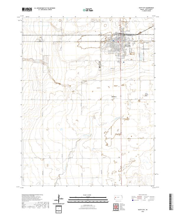
2022 Map of Scott City
USGS Topo · Published 2022About this map
Scott City serves as the focal point of this western Kansas survey, displaying a dense grid of streets and municipal infrastructure that highlights its role as a regional hub. The Scott County Courthouse stands at the center of the town, surrounded by arterial routes like W Bellevue Ave and E 5th St. To the south, the landscape transitions into the drainage area of White Woman Cr, which meanders toward the White Woman Basin. This hydrological pattern, including Lion Cr, defines the local topography and historical settlement patterns in the High Plains. Outside the main city limits, the Scott County Cem and the Scott City Municipal Airport mark the perimeter of the developed area, while the smaller locality of Hutchins appears along the southern highway corridor. The rigid section lines and county road system, including N Indian Rd and W RD 160, illustrate the structured agricultural development of the region.
Find a feature on this map
69 named features on this map. Tap any name to fly to it.
Don’t see what you’re looking for? This feature index may not catch every label — zoom into the map to look around manually.
Map Details
Editions of this 2022 Scott City Map
This is the sole edition of this map. No revisions or reprints were ever made.
Other maps of this area

1939 · Sandon
USGS Topo · 1:62,500

1939 · Pence
USGS Topo · 1:62,500

1940 · Scott City
USGS Topo · 1:62,500

1941 · Modoc
USGS Topo · 1:62,500

1941 · Pence
USGS Topo · 1:62,500

1942 · Sandon
USGS Topo · 1:62,500

1951 · Scott City
USGS Topo · 1:62,500

1951 · Modoc
USGS Topo · 1:62,500

1955 · Scott City
USGS Topo · 1:250,000

1958 · Scott City
USGS Topo · 1:250,000