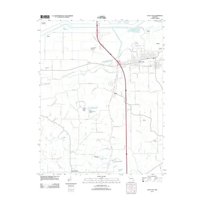
2012 Map of Scott City
USGS Topo · Published 2012About this map
Scott City and Illmo anchor the northeastern corner of this 2012 survey, situated along the Mississippi River near the edge of the Southeast Lowlands. The landscape is defined by massive water management projects, most notably the Castor River Diversion Channel and the Sals Creek Diversion Channel, which reroute the natural flow across the alluvial plain. In the southern portion of the quadrangle, the community of New Hamburg and the smaller settlement of Kelso sit among a network of family-named orchards and water bodies such as Diebold Orchards Lake Section 13 and Mothershead Lake. Several burial sites, including Mount Zion Cemetery and Ancell Cemetery, provide important touchstones for local genealogical research in this river-adjacent region of Missouri. The Cape Girardeau Municipal Airport and a prominent interstate corridor illustrate the modern transportation infrastructure that now overlays this historically agriculture-dependent terrain.
Find a feature on this map
99 named features on this map. Tap any name to fly to it.
Don’t see what you’re looking for? This feature index may not catch every label — zoom into the map to look around manually.
Map Details
Editions of this 2012 Scott City Map
This is the sole edition of this map. No revisions or reprints were ever made.
Other maps of this area

1920 · Jonesboro
USGS Topo · 1:62,500

1922 · Cape Girardeau
USGS Topo · 1:62,500

1923 · Jonesboro
USGS Topo · 1:62,500

1924 · Cape Girardeau
USGS Topo · 1:62,500

1934 · Thebes
USGS Topo · 1:62,500

1934 · Morley
USGS Topo · 1:62,500

1939 · Morley
USGS Topo · 1:62,500

1939 · Thebes
USGS Topo · 1:62,500

1947 · Jonesboro
USGS Topo · 1:62,500

1947 · Mc Clure
USGS Topo · 1:24,000