
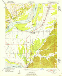
1947 Map of Mc Clure
USGS Topo · Published 1954About this map
Mississippi River dominates this landscape where the borders of Illinois and Missouri meet, defining a complex network of chutes and towheads. The river’s historical path is traced by features like Picayune Chute and Devils Island, while the Illinois side is heavily engineered with the Main Ditch and Clear Creek Ditch to manage the low-lying bottomlands. Settlement is concentrated along the rail lines, with McClure and Reynoldsville serving as local hubs for the surrounding agricultural tracts.
Find a feature on this map
43 named features on this map. Tap any name to fly to it.
Don’t see what you’re looking for? This feature index may not catch every label — zoom into the map to look around manually.
Map Details
Editions of this 1947 Mc Clure Map
3 editions found
Other maps of this area

1920 · Jonesboro
USGS Topo · 1:62,500

1922 · Cape Girardeau
USGS Topo · 1:62,500

1923 · Jonesboro
USGS Topo · 1:62,500

1924 · Cape Girardeau
USGS Topo · 1:62,500

1934 · Thebes
USGS Topo · 1:62,500

1934 · Morley
USGS Topo · 1:62,500

1939 · Morley
USGS Topo · 1:62,500

1939 · Thebes
USGS Topo · 1:62,500

1947 · Jonesboro
USGS Topo · 1:62,500
1947 · Ware
USGS Topo · 1:24,000