
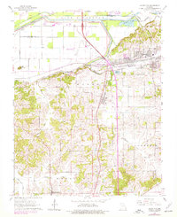
1963 Map of Scott City
USGS Topo · Published 1964About this map
The Mississippi River defines the northeastern corner of this landscape, where the Headwater Diversion Channel and Dutchtown Ditch orchestrate the drainage of the lowlands near Nash. The 1960s economy of the region is anchored by the Cape Girardeau Municipal Airport and a convergence of rail lines, including the St Louis-San Francisco and the Southwestern.
Find a feature on this map
44 named features on this map. Tap any name to fly to it.
Don’t see what you’re looking for? This feature index may not catch every label — zoom into the map to look around manually.
Map Details
Editions of this 1963 Scott City Map
2 editions found
Other maps of this area

1920 · Jonesboro
USGS Topo · 1:62,500

1922 · Cape Girardeau
USGS Topo · 1:62,500

1923 · Jonesboro
USGS Topo · 1:62,500

1924 · Cape Girardeau
USGS Topo · 1:62,500

1934 · Thebes
USGS Topo · 1:62,500

1934 · Morley
USGS Topo · 1:62,500

1939 · Morley
USGS Topo · 1:62,500

1939 · Thebes
USGS Topo · 1:62,500

1947 · Jonesboro
USGS Topo · 1:62,500

1947 · Mc Clure
USGS Topo · 1:24,000