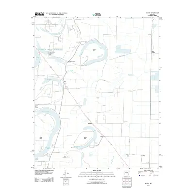
2011 Map of Scott
USGS Topo · Published 2011About this map
Toltec Mounds stands as a prominent cultural landmark on this survey of the Arkansas River floodplain east of Little Rock. The landscape is defined by the shifting course of the river, leaving behind oxbows and bends such as Bearskin Lake, Horseshoe Lake, and Old River Lake. These water features dictate the layout of local roads and the placement of small communities like Scott, Hamiter, and Walkers Corner. The area is notably dense with burial sites, including Simmons Cemetery, Le Grande Cemetery, and All Souls Rest Cemetery, which provide valuable location data for genealogists and local historians.
Find a feature on this map
75 named features on this map. Tap any name to fly to it.
Don’t see what you’re looking for? This feature index may not catch every label — zoom into the map to look around manually.
Map Details
Editions of this 2011 Scott Map
This is the sole edition of this map. No revisions or reprints were ever made.
Other maps of this area

1891 · Little Rock
USGS Topo · 1:125,000

1893 · Little Rock
USGS Topo · 1:125,000

1935 · Mc Almont
USGS Topo · 1:24,000

1935 · Sweet Home
USGS Topo · 1:24,000

1937 · England
USGS Topo · 1:48,000

1939 · Keo
USGS Topo · 1:31,680

1940 · Lonoke
USGS Topo · 1:62,500

1940 · Woodson
USGS Topo · 1:31,680

1941 · Keo
USGS Topo · 1:31,680

1942 · Scott
USGS Topo · 1:31,680