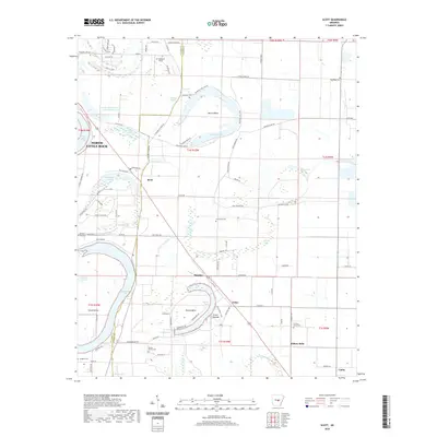
2020 Map of Scott
USGS Topo · Published 2020About this map
The Toltec Mounds archaeological site and the oxbow lakes of the Arkansas River basin define this landscape southeast of North Little Rock. The area is shaped by the winding path of the river, leaving behind dramatic bends like Dortch Bend and Dooley Bend, along with numerous remnants of former channels such as Old River Lake and Bearskin Lake. These water features, including wetlands like Bullneck Brake, created a fertile but challenging environment for the early settlements of Scott and Hamiter.
Find a feature on this map
96 named features on this map. Tap any name to fly to it.
Don’t see what you’re looking for? This feature index may not catch every label — zoom into the map to look around manually.
Map Details
Editions of this 2020 Scott Map
This is the sole edition of this map. No revisions or reprints were ever made.
Other maps of this area

1891 · Little Rock
USGS Topo · 1:125,000

1893 · Little Rock
USGS Topo · 1:125,000

1935 · Mc Almont
USGS Topo · 1:24,000

1935 · Sweet Home
USGS Topo · 1:24,000

1937 · England
USGS Topo · 1:48,000

1939 · Keo
USGS Topo · 1:31,680

1940 · Lonoke
USGS Topo · 1:62,500

1940 · Woodson
USGS Topo · 1:31,680

1941 · Keo
USGS Topo · 1:31,680

1942 · Scott
USGS Topo · 1:31,680