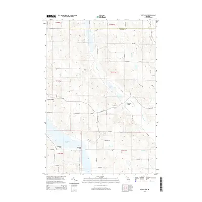
2014 Map of Scotts Lake
USGS Topo · Published 2014About this map
Intermediate Lake and the Intermediate River anchor this Antrim County landscape, which transitions from the village of Central Lake into a complex network of glacial water bodies and highland terrain. The waterway system includes Sixmile Lake to the north and the smaller Scotts Lake and Beals Lake at the center, illustrating the interconnected drainage patterns typical of this part of Michigan. The settlement pattern is defined by the valley floor at Pleasant Valley and the presence of family-linked landmarks and burial grounds, such as Densmore Cem and Morehouse Cem. Significant elevations like Bunker Hill and Dingle Hill rise above the basin, while the shoreline is punctuated by named locations like Deep Water Point and Recreation Point. This topographic survey shows how the local road network, including W Old State Rd and M-66, has adapted to the ridges and riparian corridors of the Chain o' Lakes region.
Find a feature on this map
83 named features on this map. Tap any name to fly to it.
Don’t see what you’re looking for? This feature index may not catch every label — zoom into the map to look around manually.
Map Details
Editions of this 2014 Scotts Lake Map
This is the sole edition of this map. No revisions or reprints were ever made.
Other maps of this area

1954 · Central Lake
USGS Topo · 1:62,500

1954 · Traverse City
USGS Topo · 1:250,000

1955 · Cheboygan
USGS Topo · 1:250,000

1956 · Mancelona
USGS Topo · 1:62,500

1957 · Elk Rapids
USGS Topo · 1:62,500

1958 · Cheboygan
USGS Topo · 1:250,000

1958 · Traverse City
USGS Topo · 1:250,000

1961 · Boyne City
USGS Topo · 1:62,500

1975 · Mancelona NE
USGS Topo · 1:24,000

1975 · Mancelona NW
USGS Topo · 1:24,000