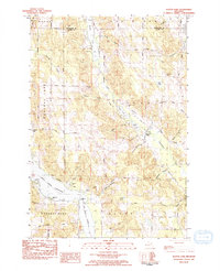
1983 Map of Scotts Lake
USGS Topo · Published 1984About this map
Central Lake and the interconnected waterways of the Chain o' Lakes dominate this early 1980s landscape, where the northern Michigan timber and agricultural legacy meets growing recreational use. The Dingman River and Dingman School highlight the importance of the interior valleys between the higher elevations of Bunker Hill and Densmore Hill. Evidence of early settlement persists through the Morehouse Cem and Densmore Cem, while the emergence of seasonal tourism is visible at Snowflake Camp, Echo Park, and the Pleasant Valley Camp. The eastern edge of the survey transitions into the protected timberlands of the Mackinaw State Forest, providing a clear contrast between the developed lakefront corridors and the more secluded forest and wetland environments of the Taylor Creek and Fisk Creek drainages.
Find a feature on this map
61 named features on this map. Tap any name to fly to it.
Don’t see what you’re looking for? This feature index may not catch every label — zoom into the map to look around manually.
Map Details
Editions of this 1983 Scotts Lake Map
This is the sole edition of this map. No revisions or reprints were ever made.
Other maps of this area

1954 · Central Lake
USGS Topo · 1:62,500

1954 · Traverse City
USGS Topo · 1:250,000

1955 · Cheboygan
USGS Topo · 1:250,000

1956 · Mancelona
USGS Topo · 1:62,500

1957 · Elk Rapids
USGS Topo · 1:62,500

1958 · Cheboygan
USGS Topo · 1:250,000

1958 · Traverse City
USGS Topo · 1:250,000

1961 · Boyne City
USGS Topo · 1:62,500

1975 · Mancelona NE
USGS Topo · 1:24,000

1975 · Mancelona NW
USGS Topo · 1:24,000
Featured Places
- Central Lake, MI
- Central Lake Township, MI
- Kearney Township, MI
- Forest Home Township, MI
- Echo Township, MI